The Greatest Debate in Design History | The NYC Subway Map
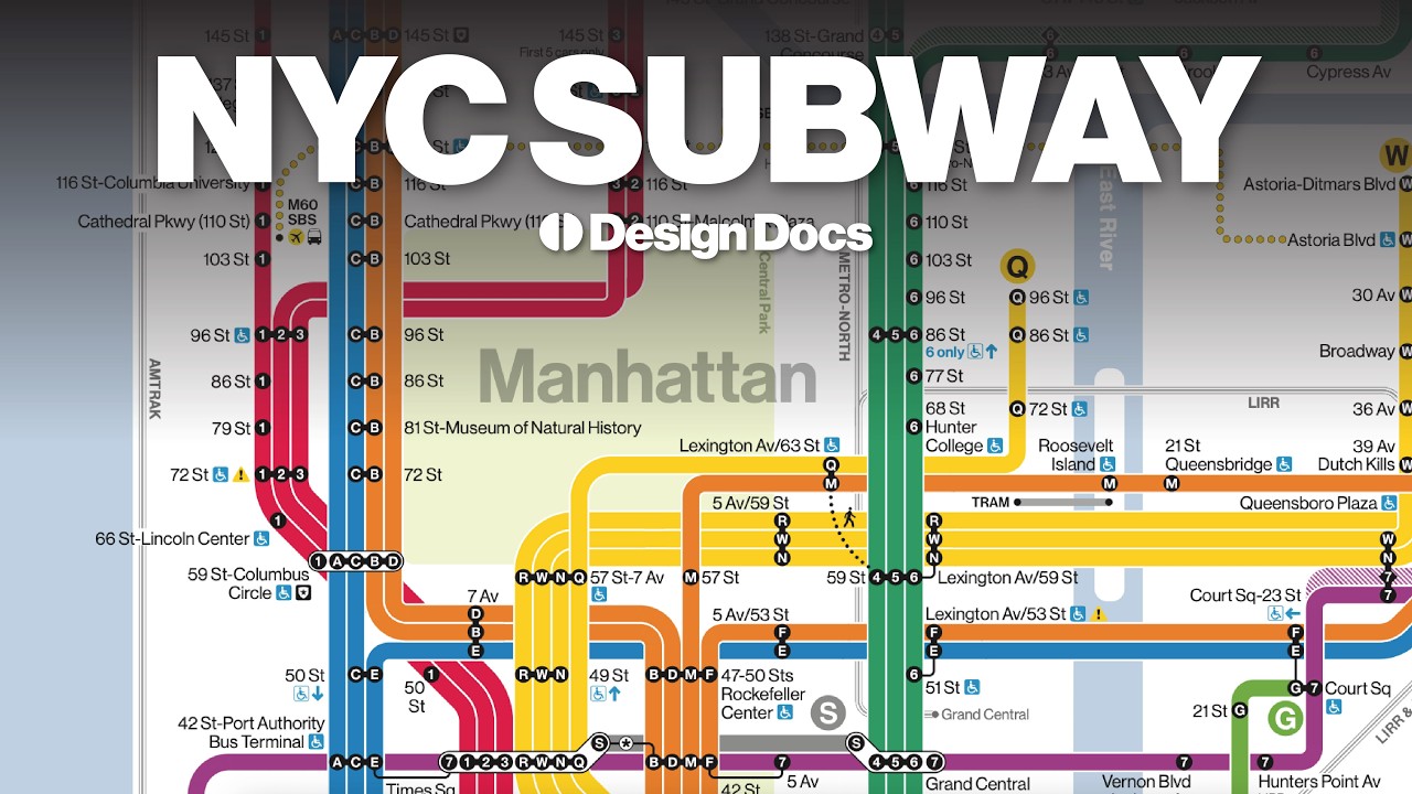
For over 50 years, one map has divided designers, urban planners, and millions of New York City riders. In 1972, Massimo Vignelli reimagined the subway map as a radical, colorful diagram, stripping away streets, shrinking Central Park to a square, and turning geography into geometry. Designers called it a masterpiece. New Yorkers couldn’t find their stop. The map was replaced in 1979, but the argument never ended. From the system’s chaotic beginnings in 1904, through Vignelli’s bold vision, the bitter backlash, and the surprising return of his ideas in 2025.
Instagram: @bctld
Portfolio: singlespeed.us
Accéder à la chaine Youtube